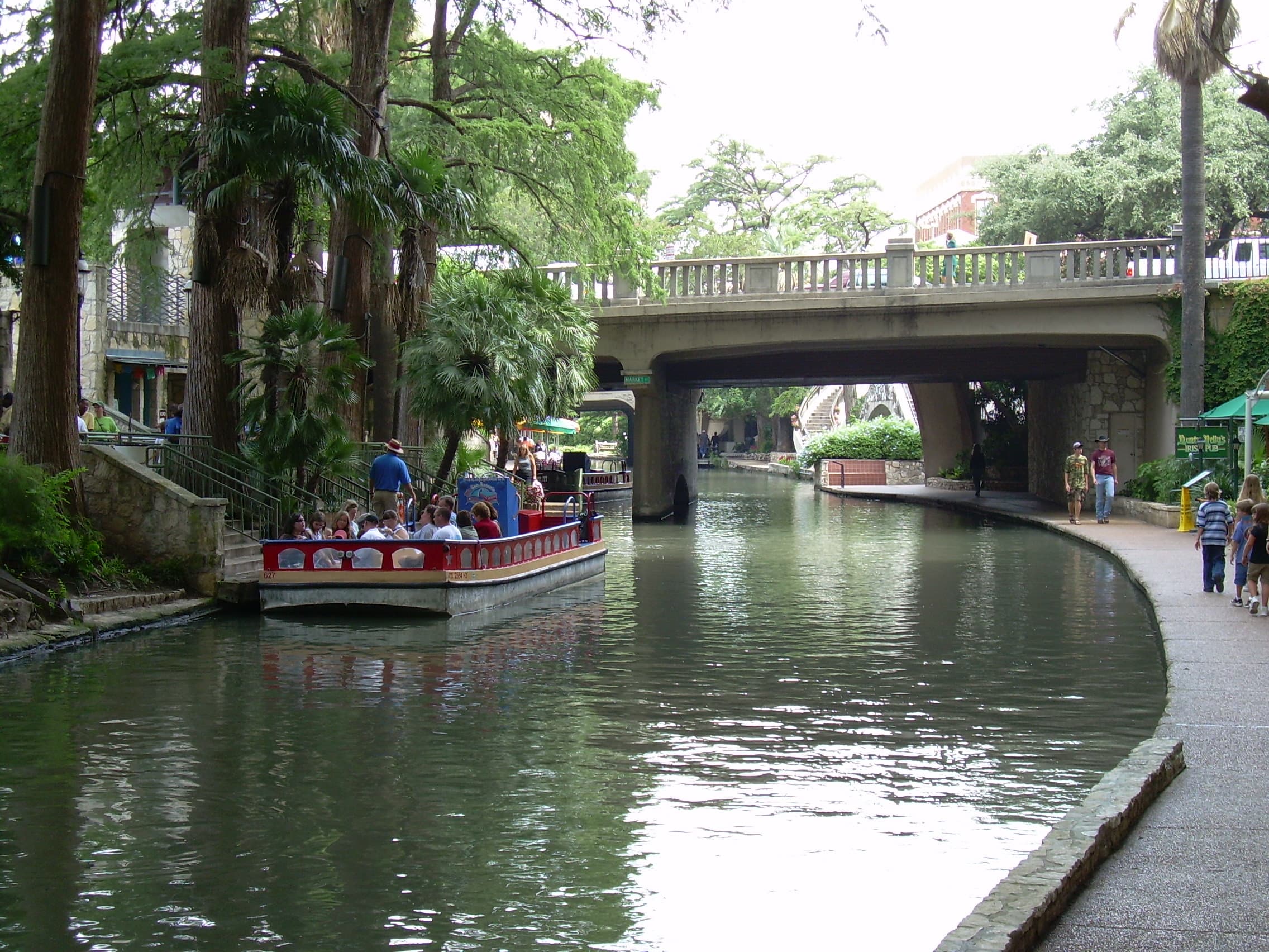
The Riverwalk.
Generational compounding — patience as a public asset.
the corridor before
Before
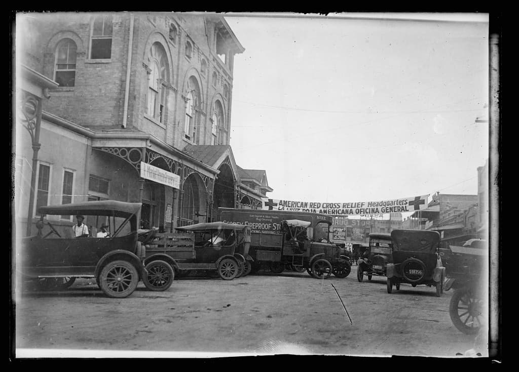
The River Walk begins not with parkland but with drowning. Downtown San Antonio in 1921 was a low, dense, mixed Anglo—Mexican commercial district built on top of an unmanaged riverbend that had flooded repeatedly through the nineteenth century. Olmos Creek drained an enormous watershed straight into the heart of the city, and basements throughout the central business district sat below the historical high‑water line. On the night of September 9–10, 1921, the remnants of a Gulf hurricane stalled over the upper San Antonio River watershed. Up to fourteen inches of rain fell over Olmos Creek; downtown received more than seven inches from a single storm cell. Water depths on Josephine Street reached seven feet; in pockets of the business district, twelve. Every basement downtown filled.
The official municipal death toll was 51, with 23 additional missing. The USGS field team at the time put the true toll at 215 to 224. The discrepancy is the founding fact of this case. The worst‑hit area was the predominantly Mexican‑American West Side, where workers and families lived in unrecorded shacks along San Pedro and Alazán creeks. USGS researcher C.E. Ellsworth wrote that “Mexicans who lived in poorly constructed houses” disproportionately drowned, and that “many others … were never reported missing.” Property damage in the business district was assessed at $3.7 million in 1921 dollars — roughly $56 million in 2021 dollars, per the San Antonio River Authority — with some contemporary estimates running as high as $19 million.
The 1921 flood, a century of disinvestment in the West Side, and twenty‑first‑century gentrification form a single environmental‑justice arc— and the River Walk’s original racial geography is reproduced by every new round of riverside reinvestment that lacks anti‑displacement guardrails.
— Char Miller's argument in West Side Rising (Trinity University Press, 2021), paraphrased
The civic response had two parts. Upstream, a $1.5 million bond paid for Olmos Dam, completed in 1926, plus a downtown bypass channel. At the downtown bend itself, the city’s engineers proposed something more drastic: pave the Great Bend over and convert it into a covered concrete storm sewer. The bend was viewed as a flood liability, a mosquito breeder, and an obstacle to rationalizing the street grid. The proposal was real, funded in concept, and on the verge of council approval.
It was defeated by a small group of civic activists, almost entirely women, organized as the San Antonio Conservation Society, founded March 23, 1924, by Emily Edwards and Rena Maverick Green. In September 1924, Edwards staged a puppet show titled The Goose with the Golden Eggs for the City Commissioners. The goose represented San Antonio; the golden eggs were its Heart of Texas, missions, history, beauty, tourists, and civic pride. The point was that paving the river was killing the goose. The puppet show is now part of San Antonio civic mythology; what matters historically is that the Society won. By 1929 the paving proposal was dead.
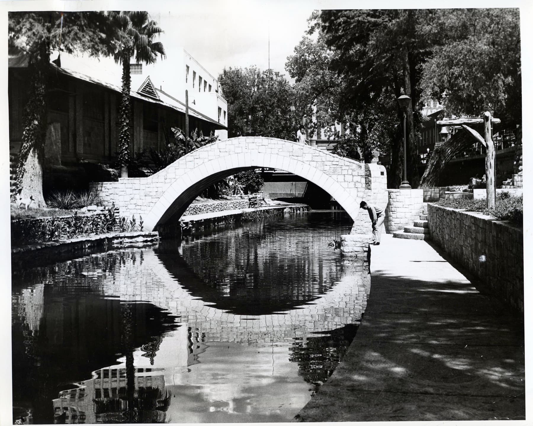
Into that opening came Robert H. H. Hugman (1902–1980), a San Antonio‑born, Chicago‑trained architect with no major commissions. In 1929 he presented the Conservation Society and the city with an unsolicited plan titled The Shops of Aragon and Romula— a romantic Spanish‑Mediterranean reimagining of the Great Bend as a sunken cobblestone shopping district with gates at each end to seal it during high water. His drawings, now held by the Alexander Architectural Archive at UT Austin, show Aragon descending from Houston Street and Romula ringing the bend, threaded with stone footbridges, shops, restaurants, and sunken gardens. Hugman lobbied for seven years, mostly to silence. He had a flood‑resistant design and no funding mechanism. The mechanism would arrive from Washington.
decision, timeline, cost
Build
Two things changed between 1936 and 1939. First, the Works Progress Administration was hunting for shovel‑ready civic infrastructure in the South. Second, Maury Maverick Sr.— a New Deal congressman from Texas’s 20th district and a personal ally of FDR — lost his House seat in 1938 and ran for Mayor of San Antonio. He won, took office in 1939, and immediately leveraged his Washington relationships. Maverick co‑authored the La Villita historic‑district ordinance, adopted October 12, 1939, and packaged the River Walk with La Villita restoration as a single WPA application.
The authorship was thus genuinely shared: a citizen group (the Conservation Society), a designer (Hugman), and an elected official (Maverick). Popular memory hands Hugman the singular credit, but the project does not happen without Maverick’s federal pipeline. Ground was broken March 29, 1939. The work was a mix of WPA labor on the river and National Youth Administration labor next door at La Villita.
The cost figures most widely cited in primary sources, via the Living New Deal archive, were modest even for the era:
- Total project cost: $430,000in 1939–41 dollars;
- WPA federal share: $355,000;
- City bond share: $75,000— a bond that drew controversy over questions of voter eligibility.
Adjusted to 2026 dollars (the BLS calculator puts 1940 to 2026 at roughly 22.3×), that is about $9.6 million. For scale: the much later, far more visible expansions cost vastly more. The Museum Reach (2009) ran $72 million; the Mission Reach (2013) ran $271 million. Hugman’s original River Walk was, in inflation‑adjusted terms, less than four percent of either modern extension. When the WPA handed the project to the city in March 1941, the deliverables included 17,000 feet of new sidewalks, 11,000 cubic yards of masonry, 31 stairways, three dams, 21 improved footbridges, roughly 12,000 trees and shrubs, and 8,500 feet of landscaped riverbank across 21 city blocks.
Hugman’s design philosophy was deliberate Spanish‑Mediterranean romanticism — a fantasy of stone, water, and shaded courtyards that read as revivalism but functioned as flood‑control infrastructure. The roughly twenty‑foot drop from street level to river level at the bend became a feature, not a bug: the descent gave pedestrians a contained, weather‑buffered, traffic‑free public realm. That single move — pulling the pedestrian off the street into a separate, protected horizontal plane — is the one Saint Paul should sit with longest.
Opposition during construction came mostly from downtown property owners who read the project as a make‑work boondoggle, and from rival architects and factions inside Maverick’s own administration. In March 1940, just twelve months in, Hugman discovered that Maverick had quietly redirected a shipment of cut stone from the River Walk to the adjoining La Villita project. The oversight committee fired Hugman unanimously, ostensibly over “disputes about landscaping and local politics” — though contemporary accounts note the proximate trigger was Hugman’s insistence on limestone, which is, ironically, today regarded as the signature material of the entire River Walk. Local architect J. Fred Buenzfinished construction, sticking to Hugman’s drawings; Hugman, displaced but not vindictive, kept advising the chief engineer informally through completion.
The River Walk was dedicated in March 1941, with a river carnival and a night parade on March 14. Maverick lost his re‑election bid that same year, in part because conservative opponents had successfully painted the WPA project as a New Deal extravagance. The man with the design was fired one year in; the man with the federal pipeline was voted out two years in. The structure outlasted both of them by eighty‑five years and counting.
the arc through 2026
Compound
For the first quarter‑century after dedication, the River Walk did not work. It was beautiful, it was empty, and it was widely regarded as a place respectable San Antonians did not go after dark. From the Depression through the mid‑1960s, not a single new hotel was built in San Antonio. The 1962 founding of the Paseo del Rio Association by riverfront merchants was a holding action, not an inflection. This is the part of the story most precedent arguments skip, and it is the part Saint Paul most needs: a defended, well‑designed public spine can sit dormant for a generation and still pay off. Patience is the asset.
The inflection was HemisFair ’68, the official World’s Fair held April 6 through October 6, 1968, on a 96.2‑acre site at the southeastern edge of downtown. Sold to the city as a Cold‑War‑era Pan‑American cultural exposition, it functioned as a federal‑state‑municipal capital project: it built a convention center, a hotel cluster, an extension of the River Walk to the convention lagoon (designed by O’Neill Ford, begun in late 1966), and the Tower of the Americas. More than six million people visited.
Crucially, HemisFair brought hotels with riverfront frontagefor the first time. The Hilton Palacio del Rio — 485 rooms, 21 stories — opened April 1, 1968, five days ahead of the fair. The H. B. Zachry Company built it in 202 working days using modular pre‑cast guest rooms manufactured seven miles offsite and craned into place, plumbing and furnishings included. La Mansion del Rio opened the same year. Two riverfront hotels in 1968 became roughly two dozen by 2000. The 1980s and 1990s were gradual private buildout — restaurants, retail, more hotels, the Rivercenter Mall in 1988 — with development still confined to the historical bend.
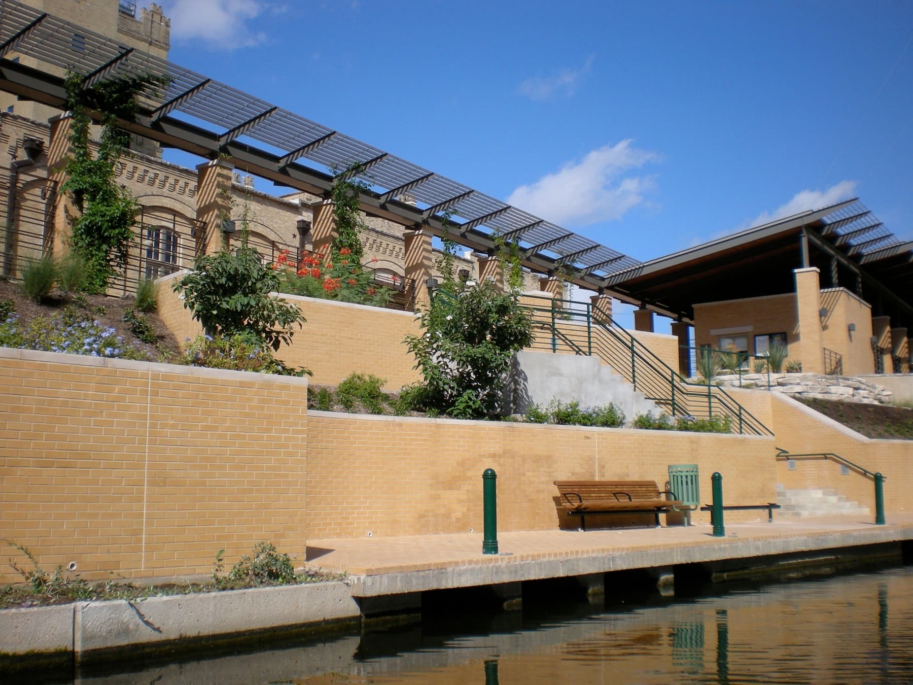
The next inflection was the Museum Reach (2009), a 1.33‑mile northern extension from downtown to the Pearl district, costing $72 million. A lock and dam at Brooklyn Avenue let barges travel north for the first time. Pearl Brewery, closed since 2001, became the anchor of a 22‑acre mixed‑use redevelopment that delivered the Culinary Institute of America’s Texas campus (2008), the Can Plant Residences (293 units, 2012), Hotel Emma (2015), and the Bottling Department Food Hall (2017). The Pearl is the canonical luxury‑anchored model — and, as the residential ledger below makes clear, its incentive stack is the part Saint Paul should treat as a warning rather than a template.
The Mission Reach (2013)is structurally different from everything before it, and it is the better model. Eight miles south from downtown to Mission Espada, completed October 2013 after Army Corps of Engineers‑led work begun in 2008, it cost $271 million as part of the larger $384.1 million San Antonio River Improvements Project. The Mission Reach is not retail. It is the largest urban ecosystem restoration project in the United States. The channel was excavated to recreate riffles, runs, and pools; banks were re‑engineered to support riparian woodland; more than 23,000 native trees and shrubs went in alongside hundreds of acres of native grasses and wildflowers. Avian benchmarking has confirmed 123 active species, and stocked Guadalupe bass are now reproducing in the restored channel, confirmed by genetic analysis. This is linear park as ecological infrastructure, not as commercial backbone.
On present‑day economics, honesty requires a distinction the celebratory accounts blur. The figure most widely repeated — approximately $3.1 billion in annual economic impact — traces in primary sources to a San Antonio River Authority general‑manager estimate tied to the return on Museum‑ and Mission‑Reach public investment. It is real and traceable, but it is a SARA estimate, not an independently audited annual visitor‑spend number. The San Antonio River Foundation now cites a separate, higher cumulative figure: more than $3.6 billion in adjacent private investment since 2003. The two numbers measure different things and should not be collapsed into one. The most rigorous single study remains Steve Nivin’s work for the City of San Antonio, which found that 31.28 percent of the city’s roughly 29.8 million annual visitors came to Bexar County primarily to visit the River Walk. The lesson for Saint Paul’s arithmetic: commission the independent analysis at year zero, so any future claim can be sourced rather than asserted.
Other downtown waterfronts have studied and partially replicated the model. Oklahoma City’s Bricktown Canal (1999, $23 million) saw canal‑adjacent property values nearly double between 2009 and 2017. Tampa’s Riverwalk draws about two million visitors a year and projects more than $1 billion in catalyzed private investment. None matches San Antonio’s scale, because none has San Antonio’s eighty‑year compounding effect. The Saint Paul Skyway, ironically, has been compounding for sixty‑plus years already — it simply has not yet been re‑narrated as a linear park.
what happened to people
Residential impact
This chapter matters most. The San Antonio Riverwalk is the most commonly cited urban‑amenity success story in the United States; it is also one of the clearest case studies in greenway‑induced displacement, and Saint Paul should not deploy it as a precedent without addressing the residential record head‑on.
At the north end, around the Pearl and the Museum Reach, the new amenity value landed directly on historically working‑class neighborhoods — Tobin Hill, Beacon Hill, Government Hill — sitting between downtown and the brewery. The result was textbook gentrification driven by a public‑investment stack layered with private incentives. The Pearl’s developer, Silver Ventures, received more than $49 millionin tax breaks, cash grants, fee waivers, and forgivable loans across the buildout. The median value of single‑family homes within one mile of Pearl rose from $250,570 in 2019 to $366,740 in 2023— a 46 percent jump in four years. Median commercial values within the same radius rose 78 percent over the same window. In Government Hill specifically, the median home value rose 75.9 percent in five years.
The city’s policy response was largely retrospective: a possible Neighborhood Empowerment Zone designation for Government Hill, a 2022 bond proposal that included $250 million for affordable housing, and incremental displacement‑mitigation language in later incentive deals. Critically, there was no requirement for a displacement‑impact study before granting Pearl‑style incentives — a gap Councilman Jalen McKee‑Rodriguez has since pressed to close.
At the south end, the Mission Reachstory is sharper, because it includes a single iconic clearance event. The Mission Reach runs through historically Mexican‑American neighborhoods that had previously been disinvested. After completion in 2013, corridor property values rose, and in May 2014 the City Council voted to rezone a riverside parcel holding the Mission Trails Mobile Home Park to allow a $75 million luxury apartment development. Approximately 300 residents in 106 mobile homeswere displaced, with the developer paying roughly $1 million in relocation assistance. The vote was 6–4 in favor; then‑Mayor Julián Castro voted against, alongside council members Diego Bernal, Rey Saldaña, and Shirley Gonzales. Castro answered the public outcry by chartering San Antonio’s first municipal task force on gentrification(November 2014 to May 2015), which became the predecessor of the city’s Housing Commission.
Gentrification threats can foster organized civic‑health responses — Vecinos de Mission Trails being the textbook case — but the “trailer‑park tenants facing displacement lacked the resources to prevail.” The civic‑health gains do not, by themselves, prevent displacement.
— Housing Policy Debate (Esquivel-Muelbert, Carrión, et al., 2022)
That peer‑reviewed finding is the load‑bearing one. Organized resistance happened, it was real, and it still could not stop the clearance, because the residents did not hold the policy instruments that would have made resistance binding. For broader grounding, the urban‑displacement literature — Zuk, Bierbaum, Chapple and colleagues, in the Journal of Planning Literature(2018) — catalogues the conditions under which public infrastructure investment accelerates displacement, and it maps almost exactly onto the San Antonio sequence.
The pattern is now openly acknowledged inside San Antonio’s own civic discourse. The most recent chapter is the $616 million Westside Creeks restoration, of which $227 million funds greenways along the Alazán, Apache, Martinez, San Pedro, and Zarzamora creeks. District 5 Council Member Teri Castillo has tied that work directly to the Mission Reach precedent, warning that “when we hear or see beautification, it’s often synonymous with increasing property taxes, predatory real‑estate practices, and displacement.” The diagnosis is no longer contested: river‑ corridor public investment generates amenity value, that value capitalizes into adjacent land prices, and absent strong tenant protections and pre‑emptive affordable‑housing guardrails, low‑income — especially Mexican‑American — communities are displaced.
The structural contrast with Saint Paul is the whole point. San Antonio reached for its displacement instruments afterthe clearance — the gentrification task force was chartered in response to Mission Trails, not in advance of it. Saint Paul already holds, before a single skyway segment is reclassified, the rent stabilization ordinance, the 4d Affordable Housing Incentive Program, and the tenant‑protection ordinance that San Antonio had to improvise in the aftermath. San Antonio built the policy bed on the way down. Saint Paul gets to build the park on top of one that already exists.
for Saint Paul
The lesson
San Antonio is the most cited urban‑amenity success story in the United States, and the optimistic half of the precedent argument writes itself: a defended, redesigned, ecologically‑informed public‑realm spine through downtown will outperform almost any other infrastructure investment a city can make on tourism, tax base, and quality‑of‑life metrics. But the value of this case is that it carries both halves at once, and the two halves resolve into a single lesson about time.
The first half is generational compounding. Hugman was fired one year into construction; Maverick was voted out two years in; and the River Walk then sat empty and unfashionable for a full quarter‑century before HemisFair ’68 turned it on. The asset that produced San Antonio’s eighty‑year payoff was not a clever financing structure or a marketing campaign. It was patience treated as a public good— a city declining to demolish, pave, or defer a piece of public space long enough for the value to arrive. Saint Paul’s Skyway has already done the hard part of that bargain. It has been compounding, unnamed, for sixty‑plus years.
San Antonio built its anti‑displacement policy after the Mission Trails clearance. Saint Paul holds that policy bed before the first segment is reclassified.
— the asymmetry Saint Paul should name out loud
The second half is the Pearl cautionary tale, and it is only half‑answered in San Antonio — which is precisely why Saint Paul is better positioned. The Pearl/Museum Reach record and the Mission Trails clearance show that public investment in a linear park is a displacement accelerant unless it is paired, on day one, with binding protections. San Antonio reached for those instruments retrospectively; Saint Paul already holds them. The rent stabilization ordinance, the 4d Affordable Housing Incentive Program, and the tenant‑protection ordinance are the policy bed San Antonio spent a decade improvising after the harm was done.
So the reclassification effort should carry San Antonio’s own hard‑won corrections at the front of the policy stack: a Mission‑Reach‑style ecological and public‑realm model rather than a Pearl‑style luxury‑anchored one for any net‑new development near skyway entrances; a displacement analysis before, not after, the value arrives; an independent economic baseline at year zero; and explicit equity language ensuring the uplift of a Linear Park reaches Frogtown, Rondo, and the West Side residents who already use the Skyway as essential winter infrastructure — not only downtown commercial owners. San Antonio shows what eighty years of patient public investment in a linear spine can produce. It also shows, in the same ledger, what it costs to build that spine without guardrails. Saint Paul has the rare chance to take the first lesson and skip the second.
Sources & further reading
Where this came from.
- Char Miller. West Side Rising: How San Antonio's 1921 Flood Devastated a City and Sparked a Latino Environmental Justice Movement — Trinity University Press (review via Project MUSE) (2021)
- Char Miller. The San Antonio Flood of 1921 Held Lessons We Refuse to Learn — Texas Observer (2025)
- The Floods in Central Texas in September, 1921 — US Geological Survey, Water-Supply Paper 488 (1922)
- Flooding Flashback — 100th Anniversary of the Big Flood of 1921 — San Antonio River Authority (2021)
- Hugman, Robert Harvey Harold — Texas State Historical Association, Handbook of Texas
- Puppet Show — San Antonio Conservation Society
- River Walk - San Antonio TX — Living New Deal
- One man is credited with creating the River Walk. He got fired halfway through the project — KSAT (2024)
- HemisFair '68 — Texas State Historical Association, Handbook of Texas
- Rise of the Pearl: How a Historic Brewery Transformed a City — San Antonio Report (2017)
- San Antonio Heron. ‘We’ve been gentrified.’ McKee-Rodriguez spurring new conversation about gentrification in San Antonio — San Antonio Heron
- Ecological Success Stories — San Antonio River Foundation (2026)
- Steve Nivin, Ph.D.. Impact of the San Antonio River Walk — Study for the City of San Antonio (via RFP archive) (2014)
- Esquivel-Muelbert, Carrión, et al.. Can Gentrification Battles Promote Civic Health? A Case Study Analysis in San Antonio, Texas — Housing Policy Debate (DOI 10.1080/10511482.2022.2076714) (2022)
- Zuk, Bierbaum, Chapple, Gorska, Loukaitou-Sideris. Gentrification, Displacement, and the Role of Public Investment — Journal of Planning Literature (2018)
- City Council Approves Rezoning Mission Trails Mobile Home Park — San Antonio Current (2014)
- Westside Creeks, once a flood hazard, now face a new challenge: gentrification — San Antonio Report